
|
How to collect a point feature |
|
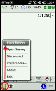
Before you collect point features, you must Start a Survey with File > Start Survey. Once a survey is started, the GNSS Survey Toolbar is displayed and allows to record GIS features. |
|
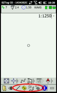
The first icon (
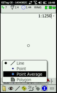
If the feature is a Point Average (defined in the data dictionary), you can set its duration in File > Preferences > Tagging. For more details, refer to article Configure feature point duration. |
|
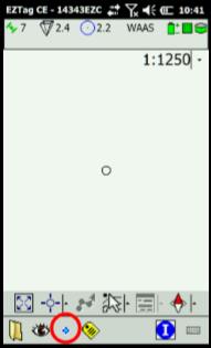
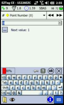
Once the data capture starts, you are able to enter the feature attributes. |
|
You can navigate trough the feature attributes with the dropdown list If you use a custom dictionary with tag sheet feature (form), simply navigate trough your feature attributes with your stylus; The very first attribute When entering an attribute, you can define it as the new default value by clicking on If you are recording a Point Average, the progress bar Once all Attributes have been entered, click on |
|
For more details on features and attributes, refer to articles Default data dictionary and Use a custom data dictionary. |
|
Article: 000072 Related Products: EZTag CE Last Update: 2017-04-04 21:21:03 |
|
Document information |
|
|