
|
EZField - How to navigate |
|
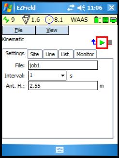
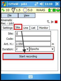
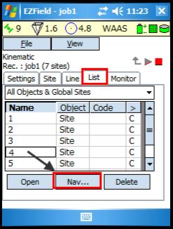
How to navigate (go to) In order to navigate to a site (point), a Kinematic survey or a Semi-kinematic survey must be started. 1. Start a Kinematic or a Semi-kin survey file: select the survey type and start 2. Record sites (points) using the Site tab; 3. Once sites have been recorded, go to the List tab; 4. From the list of recorded sites, select the site you want to navigate to and the Nav… button; |
|
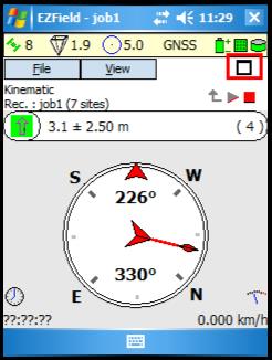
5. The Navigation View is displayed and gives the following information:
■ The distance between your actual GNSS position and the target; ■ The bearing between your actual GNSS position and the target; ■ When you move toward the target, the time left to get to destination is displayed (bottom left corner); ■ When you move toward the target, your speed is displayed (bottom right corner); ■ The compass helps to define your direction (your bearing). When the two arrows are aligned, it means you are moving toward the good direction.
The information will be updated has you move toward the target. When you reach your destination, click on |
|
NOTE: In Semi-kinematic mode, it is possible to navigate using the Init tab (rather than the List tab). The Init tab only allows to navigate to the known sites that can be used to initialize the survey (refer to article Semi-kinematic mode for more details). |
|
Article: 000094 Related Products: EZField Last Update: 2016-07-14 18:44:15 |
|
Document information |
|
|