
|
EZTag CE - How to navigate |
|
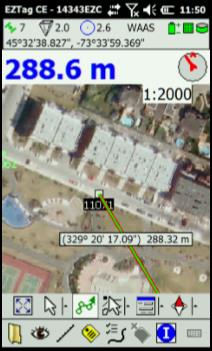
The displayed navigation information are: ■ The distance between your actual GNSS position and the target ■ The bearing between your actual GNSS position and the target ■ A compass to help define your direction (your bearing) When the two arrows are aligned (they become green), it means you are moving into the right direction
The information will be updated has you move toward the target. When you reach your destination, click on |
|
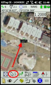
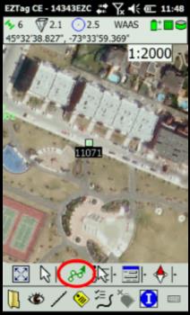
How to navigate (go to) 1. Select For more details on background files refer to Display background Shapefiles or Display background GNSS Surveys. 2. Click on Navigate to |
|
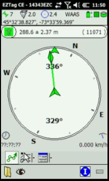
To navigate to your destination you can also use the Navigation View available with the View menu. The displayed navigation information are: ■ The distance between your actual GNSS position and the target ■ The bearing between your actual GNSS position and the target ■ When you move toward the target, the time left to get to destination is displayed (bottom left corner) ■ When you move toward the target, your speed is displayed (bottom right corner) ■ The compass helps to define your direction (your bearing) When the two arrows are aligned (they become green), it means you are moving into the right direction
The information will be updated has you move toward the target. When you reach your destination, click on |
|
Article: 000079 Related Products: EZTag CE Last Update: 2016-07-14 18:44:15 |
|
Document information |
|
|