
|
Display background GNSS surveys |
|
Features of previously recorded EZTag CE GNSS surveys can be loaded as background maps. A background map cannot be edited. An Item (feature) available in the background map can be selected to view its attributes or to navigate to the feature. |
|
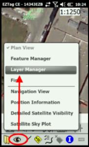
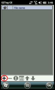
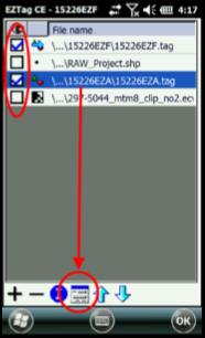
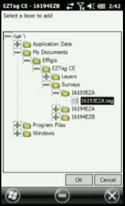
Display the features of a previously recorded GNSS survey 1. Select View > Layer Manager; 2. Add you background maps with the 3. Browse for your GNSS surveys (*.TAG) and click on it to add it to your list of background maps; 4. Check the checkbox to display the GNSS survey file (you can select many files); 5. Select the file and press the properties icon 6. Press ok to save your selections and your shapefiles are going to be displayed in the Plan View |
|
|
|
Article: 000070 Related Products: EZTag CE Last Update: 2016-07-14 18:44:15 |
|
Document information |
|
|