|
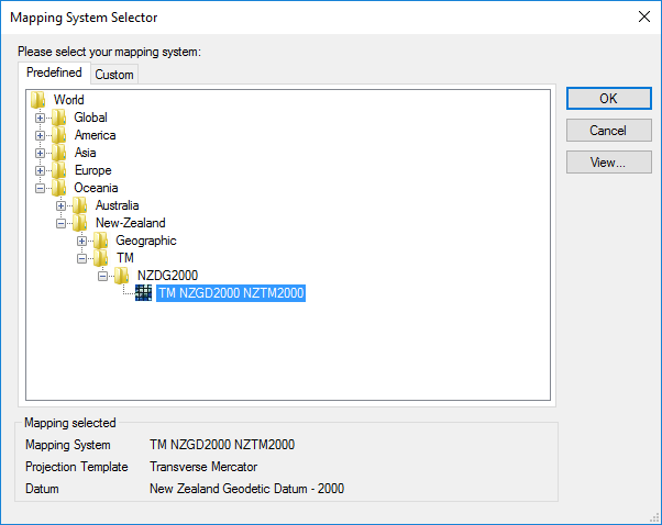
How to select a Mapping System · Under Tools > Mapping Systems > Selector, you can access a predefined or custom list of Projected Systems and Geographic Systems. You can also click on the following icon · You have to make sure that your selected mapping system uses the proper datum (covering your area). Use the View... button to find out. · Predefined Mapping Systems cannot be edited. · You can create custom Mapping Systems if you cannot find it in the predefined list. |

|
How to select a predefined Mapping System |
|
Article: 000004 Related Products: EZSurv Last Update: 2017-04-05 20:55:21 |
|
Document information |
|
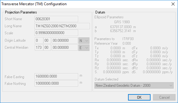
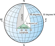
-A Projected system is defined by a Map Projection template (Transverse Mercator, Lambert, Azimutal, etc.) and a Datum (we supports 18 specific map projection templates and over 70 predefined datum). -A Geographic System is simply defined by a Datum. -Whereas a Datum is defined by an Ellipsoid and a set of 15-Parameters transformation. |
|
When you select your mapping system, if you click on the View… button, you will see all its related parameters. |
|
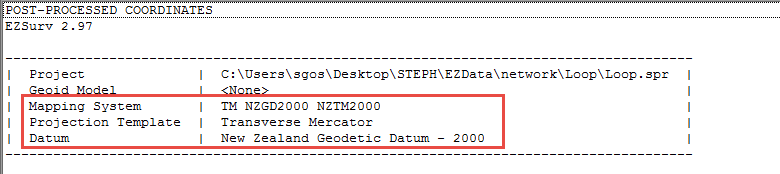
From there, all your positions will be presented in the selected Mapping System. |
|
|
|
What is a Mapping System in EZSurv?
A mapping system in EZSurv™ can be a:
· Projected System or a · Geographic System. |